Snapshot of Eastbrook School
Welcome to the Department of Geography.
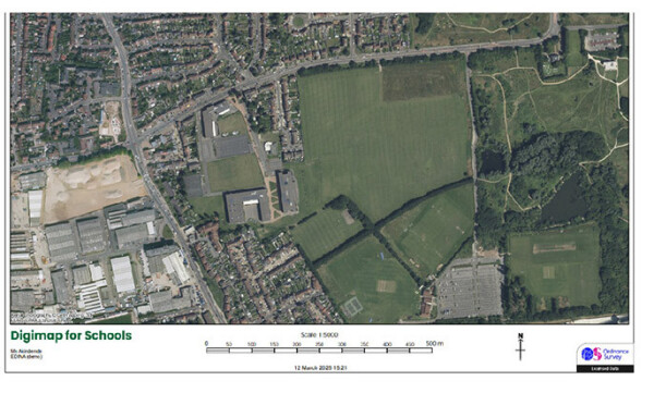
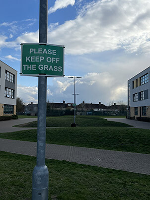
At first glance, this is a birds eye view of somewhere. Our Year 10s would point out it is most likely in the mid-latitude region of the globe, indicated by the foliage pattern; by where the trees are. Take a closer look. Do you recognise the zig-zag pattern made by the paths between mounds with "Please keep off the grass" signs, separating the teaching block from the specialist block? You might also recognise grass students are allowed onto; can you see the football pitch and the sports ground? In fact, this single aerial photograph provides a snapshot of Dagenham today, with the industrial estate, factories and warehouses towards the south west of the photograph, and the boggy marshland surround the inland water in the north east of the photograph.
Our all through, co-educational school, and lots of terraced, Victorian housing - residential land use - towards the centre and north of the photograph. Do these photos show the joy of rushing along the zig-zag path (or a desire line across the mound) to the canteen during lunch break, or finally understanding how rain weathers the car park? Maybe not but it is a snapshot of deindustrialisation in Britain, of our corner of the England, of human and physical geography. We still make things, we sometimes walk on the grass and what people do is as important to us as what rocks do.
In the next update from the Department of Geography, we will meet Travel the Tyrannosaurus Rex and explore the weather with him, just as our Year 8s have been this term.